
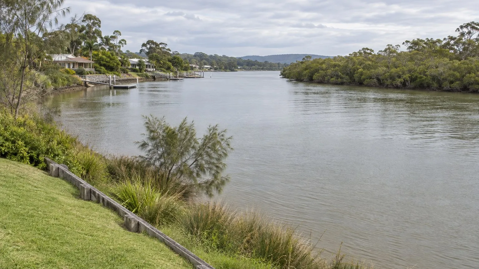
You find a site with water at the end of the street and a view that will sell the product. The planner likes the yield, the engineer says the stormwater needs an outlet, and the design puts a retaining structure along the top of the bank to gain a building platform.
In New South Wales that retaining structure, and possibly a good deal more, is a controlled activity on waterfront land. It needs its own approval, and your development consent does not give it to you.
The deal question: is any of your work in or on waterfront land?
The controlled activity approvals page answers the boundary question directly. It states that waterfront land includes the bed of rivers, lakes, or estuaries, and land on each side within 40 metres of a riverbank.
The page then lists what a controlled activity includes: erecting a building; carrying out works including laying pipes and cables in a watercourse, and constructing bridges, roads, control measures and sea walls; removing material from waterfront land including vegetation, rocks, sand and gravel; depositing material on waterfront land including gravel or fill; any activity that affects the quantity or flow of water in a water source; and vegetation management.
Read that against a normal subdivision or duplex job near water. A stormwater outlet, a driveway crossing, a retaining wall, an access track, a landscaping strip along the bank and even a building envelope can each sit inside the list.
Why the 40 metres is a survey problem, not a plan problem
The compiled Act text defines waterfront land to include the bed of a river, lake or estuary and land within the prescribed distance inland of the mean high water mark, where the prescribed distance is 40 metres unless the regulations prescribe a lesser distance generally or for a particular location or class of locations.
Every word in that definition is a measurement instruction. The bed, the bank and the mean high water mark are physical features, and the line is drawn from them. A boundary drawn on a subdivision plan, or an assumption that the fence marks the top of the bank, does not answer the question. On a site where the design depends on whether a building envelope falls inside the 40 metres, the answer has to come from a survey.
The trap: the approval that arrives as someone else's referral
This is what catches developers who have done everything else correctly. The departmental page states that most controlled activities also need approval from a local council, and that if this is the case you must lodge what is known as an integrated development application with that council, which is then referred to the department. It also records that all applications for controlled activity approvals are lodged and managed in the NSW Planning Portal.
So the approval is not part of your consent. It is a separate consent that is triggered by the referral of your development application. If your planner does not identify the integrated development issue at lodgement, you can find out about the water approval after the assessment has already been underway, and the referral becomes a stop on the clock rather than a line in your programme.
The department's own waterfront land page describes using the e-tool to understand at pre-development application stage whether the development is considered integrated development and therefore should be referred by the local council to the department, and to provide evidence to a council about the need to refer your application. That is the sequencing instruction: settle the question before lodgement.
What the application needs, and why it is a design document
The controlled activity approvals page sets out the documents a controlled activity approval application requires. They include site plans with demarcation of waterfront land, designated riparian corridors and any encroachments and offsets; a vegetation management plan; drainage and stream works plans; detailed stormwater outlet designs; and costing of works and security bonds where specified.
Those are not forms. They are design outputs, and each one changes as the layout changes. A site plan that demarcates waterfront land cannot be produced until the bank and the 40 metre line are surveyed. A detailed stormwater outlet design cannot be produced until the outlet location is fixed. Vegetation management along a riparian corridor cannot be written until the corridor is mapped.
That means the water approval work sits inside your design process, not after it, and it should be priced as a design-stage cost rather than an approval-stage fee.
Exemptions are real, mapped and not self-certifying
There is a genuine exemption pathway, and it is worth checking early. The controlled activity approval exemptions page states that not all activities on waterfront land need a controlled activity approval, that there are several exemptions under the Water Management (General) Regulation 2025, and that the controlled activity exemptions e-tool is the way to check whether an exemption applies to your activity.
It lists mapped exempt waterfront land areas, including the Botany Bay and Georges River area, the Brisbane Water area, the Hunter River area, the Lake Macquarie area, the Lake Mulwala area and the Port Hacking area, defined under section 64 and Schedule 4 of the Regulation.
Two cautions come with the exemption. The page states that even where an activity is exempt you may still need to obtain other approvals required under other legislation, and that you should contact the relevant local council. It also records that the e-tool report cannot be used as an approval to undertake work on waterfront land or as evidence of compliance with the Water Management Act 2000.
The waterfront land page carries the same disclaimer for the waterfront land e-tool: it applies only to controlled activities on waterfront land and its results cannot be used as an approval or as evidence of compliance. Keep the results — the exemptions page recommends a copy in case the regulator requests evidence — but treat them as a screening finding, not a permission.
The site test a student would run, in order
- Identify the water source and have the bank and mean high water mark surveyed, then set out the waterfront land line on a plan.
- Overlay the design and mark every proposed work inside that line: buildings, retaining structures, outlets, crossings, tracks, pipes, vegetation removal and landscaping.
- Run the exemptions e-tool and the waterfront land e-tool, and keep the results in the project file.
- Establish the council's referral practice and confirm whether the proposal is integrated development before lodgement.
- Commission the required plans — site plans demarcating waterfront land, the vegetation management plan, drainage and stream works plans and stormwater outlet designs — as design deliverables.
- Price the approval, the security bond where specified, the survey and the specialist reports into the feasibility.
- Test the design without the intrusion. Can the layout avoid the waterfront land line entirely, and what does that cost in lots or in dwelling yield?
What this does to the offer
Run the feasibility twice: the layout that uses the waterfront land for a building platform or an easy outlet, and a layout that keeps every work outside the 40 metre line. If the second version holds most of the yield, keeping out of the waterfront land is usually the better commercial decision, because it removes a separate approval, a referral, survey work, specialist reports, a possible security bond and the risk that a condition reshapes your design late.
Where the intrusion is unavoidable, the water approval belongs on your critical path with the survey and the specialist reports in front of it, and your programme and price should show that.
Practical next steps
You are not expected to solve this yourself. A surveyor or civil engineer establishes the bank, the mean high water mark, the waterfront land boundary and the drainage, outlet and access design. A town planner confirms whether the proposal is integrated development and how the council refers it. An environmental or water consultant prepares the vegetation management plan, the stream works plans and the stormwater outlet designs the application requires. Confirm the site's waterfront land status, the current regulation and the current exemption position before you fix a design, a programme or a price.
Sources and boundaries
Sources checked 28 September 2026. Jurisdiction and limits: New South Wales specific information. This guide relies on the Water Management Act 2000 (NSW) and on current NSW Department of Climate Change, Energy, the Environment and Water guidance for controlled activity approvals, waterfront land, the waterfront land e-tool and controlled activity approval exemptions. The copy of the Act used here is the compiled text as at 1 July 2023, and the departmental pages and the Water Management (General) Regulation 2025 carry their own currency, so the current in-force versions must be confirmed. Whether land is waterfront land depends on the actual bed, bank or shoreline of the water source and the measured distance, and whether an activity is exempt depends on the current regulation, the mapped exempt areas and the department's own e-tool results. The e-tool result is expressly not an approval and not evidence of compliance. Most controlled activities also need a council approval, and integrated development referral practice and timing are set by the council and the department. Fees and assessment timeframes are updated. Other states and territories must not be assessed against this material. This is general information only.
- NSW DCCEEW Water — Controlled activity approvals. Used for: the definition of controlled activities as activities carried out on waterfront land defined as a controlled activity in the Water Management Act 2000; the definition of waterfront land as the bed of rivers, lakes or estuaries and land on each side within 40 metres of a riverbank; the listed controlled activities including erecting a building, laying pipes and cables, constructing bridges, roads and sea walls, removing material including vegetation, rocks, sand and gravel, depositing material including gravel or fill, any activity affecting the quantity or flow of water in a water source, and vegetation management; that applications are lodged and managed in the NSW Planning Portal; and that most controlled activities also need council approval, lodged as integrated development (Checked 28 September 2026)
- NSW DCCEEW Water — Development activities on waterfront land. Used for: the description and purpose of the waterfront land e-tool, including using it for a preliminary site investigation, understanding at pre-development application stage whether development is integrated development and should be referred by council to the department, providing evidence to council about referral, and supporting riparian mapping and watercourse assessment for land releases and rezoning; and the express disclaimer that the e-tool applies only to controlled activities on waterfront land and that its results cannot be used as an approval or as evidence of compliance (Checked 28 September 2026)
- NSW DCCEEW Water — Controlled activity approval exemptions. Used for: that not all activities on waterfront land need a controlled activity approval; that there are several exemptions under the Water Management (General) Regulation 2025; that the controlled activity exemptions e-tool is the way to check whether an exemption applies; that even where an activity is exempt other approvals under other legislation may still be needed and that the relevant local council should be contacted; and that mapped exempt waterfront land includes defined areas such as Botany Bay and Georges River, Brisbane Water, Hunter River, Lake Macquarie, Lake Mulwala and Port Hacking, under section 64 and Schedule 4 of the Regulation (Checked 28 September 2026)
- Water Management Act 2000 (NSW) — compiled text as at 1 July 2023 (PDF copy). Used for: the definition of waterfront land including the bed of a river, lake or estuary and land within the prescribed distance inland of the mean high water mark, where the prescribed distance is 40 metres unless the regulations prescribe a lesser distance; the controlled activity and aquifer interference activity approval provisions; and the offence for carrying out a controlled activity in, on or under waterfront land without, or otherwise than as authorised by, a controlled activity approval (Checked 28 September 2026)
This article is general education, not personalised planning, legal, financial, tax, privacy, safety or building advice. Requirements and outcomes vary by jurisdiction, site, contract, structure and circumstances. Check current information with the relevant authority and appropriately qualified advisers.
 Learn with Jason & AmyBuild practical small-scale property development skills with experienced mentors.Enquire now
Rate this article
Guest rating: select 1 star for poor or 5 stars for great. No account is required.
Leave a comment
Join the discussion. Your email address will not be published.
Frequently asked questions
How is waterfront land defined, and why does the 40 metre line matter?
It matters because it decides whether the Act applies to your works at all. The departmental controlled activity approvals page states that waterfront land includes the bed of rivers, lakes or estuaries and land on each side within 40 metres of a riverbank. The compiled Act text defines waterfront land to include the bed of a river, lake or estuary and land within the prescribed distance inland of the mean high water mark, where the prescribed distance is 40 metres unless the regulations prescribe a lesser distance generally or for a particular location or class of locations. The line is measured from a physical feature, so it has to be surveyed rather than scaled off a plan.
What kinds of work are caught by a controlled activity approval?
More than people expect. The departmental page lists controlled activities as including erecting a building; carrying out works including laying pipes and cables in a watercourse and constructing bridges, roads, control measures and sea walls; removing material from waterfront land including vegetation, rocks, sand and gravel; depositing material on waterfront land including gravel or fill; any activity that affects the quantity or flow of water in a water source; and vegetation management. A stormwater outlet, a retaining wall at the top of a bank and an access track across a paddock toward the water can all land inside that list.
Does my development application cover it, or is it separate?
It usually arrives by a different route, and that route is the referral. The departmental page states that most controlled activities also need approval from a local council, and that where this is the case you must lodge what is known as an integrated development application with that council, which is then referred to the department. All applications for controlled activity approvals are lodged and managed in the NSW Planning Portal. So the approval is a separate consent that runs with your development application, and the referral is how it reaches the department.
Can I check the position myself before I pay for consultants?
Partly, and the departmental tools are the right starting point. The waterfront land e-tool is described as helping determine whether activities are on waterfront land and whether a controlled activity approval is needed, and as usable for a preliminary site investigation, for understanding at pre-development application stage whether the development is integrated development, and for supporting riparian mapping and watercourse assessment for land releases and rezoning. The page carries an explicit disclaimer that the e-tool applies only to controlled activities on waterfront land and that its results cannot be used as an approval or as evidence of compliance. Use it to frame the question, not to close it.
Is there an exemption pathway?
There is, and it is mapped. The controlled activity approval exemptions page states that not all activities on waterfront land need a controlled activity approval, that there are several exemptions under the Water Management (General) Regulation 2025, and that the controlled activity exemptions e-tool is the way to check whether one applies. It lists mapped exempt waterfront land areas including Botany Bay and the Georges River, Brisbane Water, the Hunter River, Lake Macquarie, Lake Mulwala and Port Hacking, under section 64 and Schedule 4 of the Regulation. Two cautions come with it: the page states that even where an activity is exempt you may still need other approvals under other legislation, and it recommends using the exemptions tool together with the waterfront land e-tool. It also states that the e-tool report cannot be used as an approval or as evidence of compliance.
Loading comments…