
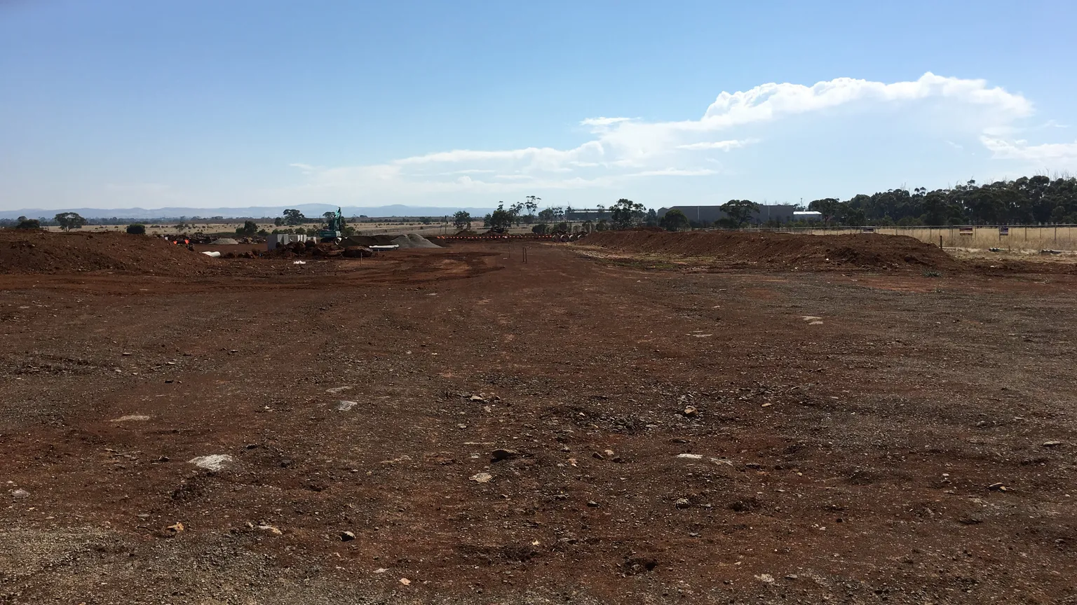
You have found a block that works on paper. The zoning supports the density you want, the planner has read the controls favourably, and the layout produces the lots the feasibility depends on. Then you stand on the site and notice that the back third falls away to the rear boundary, and that the neighbour behind has already built their floor level well above the fence.
Those two observations change the project. They decide where water runs, where each dwelling can sit, how deep you have to cut on one side and how much fill you need on the other. That is a real cost, and it is one you can measure before you make an offer.
The deal question: what does the ground already do?
Reading a site starts with two questions that have nothing to do with planning. The first is where the water goes when it rains. The second is what has to move to make each lot work. The Australian Height Datum, the national vertical datum administered by Geoscience Australia, is the reference used to express levels consistently. The same datum is the required basis for subdivision drawings: Tweed Shire Council's Development Design Specification D13 requires all levels to be to Australian Height Datum with benchmarks referenced on the plans. If your designer talks about levels without saying which datum, you cannot compare those levels to a flood level, a survey plan or a council requirement.
The checks a capable student would run, in order
- Get a feature and level survey. A registered surveyor records existing ground levels, contours, services, structures, boundary features and the levels of adjoining land. Griffith City Council's engineering guidelines expect survey work on Australian Height Datum and with coordinates, and Karratha's survey guidelines set out the survey specification, including the height datum and the maximum point spacing for the survey. Those are the documents that tell you the accuracy standard your surveyor is working to.
- Compare existing levels to the flood and hazard mapping. If the site is mapped, the council or the relevant authority sets a flood planning level and a minimum finished surface level. Some authorities require lot filling to a set height above the flood level: Griffith City Council's guidelines state that in new development areas lot filling is to ensure finished surface levels are 500 mm above the 1 in 100 year ARI flood level, and direct infill proponents to consult the authority about local requirements. Treat that figure as Griffith's requirement, not a rule for your council.
- Cost the cut and fill. Ask the civil engineer for a cut and fill balance on the surveyed levels. That is a quantity, and a quantity becomes a number of truck movements, a number of nights of earthworks, and a line in the budget. Some sites can balance on site; others need imported fill, which brings its own testing and compaction evidence.
- Test the soil. A geotechnical engineer confirms what the cut is actually cutting and what the fill will sit on. The City of Gold Coast's ground-level code is a useful illustration of the standard a council can expect: fill material must be geotechnically suitable and adequately compacted, and where a site is underlain by compressible soils a geotechnical stability assessment is expected.
- Check the drainage path and gradient. The same code expects a finished surface that is free draining, with a stated acceptable gradient for fill or excavated areas, and a hydraulic report where the change to ground level raises flooding or drainage questions. That is a good test to apply to your own design: can you state the finished gradient, and can you state where the water leaves?
Why a buildable platform is the number that matters
Every lot you create has to carry a dwelling with a floor level, a driveway, an outdoor area and a stormwater connection. The buildable platform is the area on the lot where all of those fit together. On sloping ground it is often much smaller than the lot area, and on steep ground it can shrink to nothing without substantial retaining and earthworks.
That is why the ACT's guidance on Datum Ground Level is worth understanding even if you never build in the ACT. The guidance defines datum ground level by reference to a field survey authorised by a registered surveyor, and for infill sites where the ground has already been disturbed it requires the surveyor to determine and estimate the surface of the ground across the area of disturbance. Development controls that depend on ground level, such as building height, depend on that determination. The general lesson travels: where a control is measured from existing ground level, the level is evidence, not an assumption.
The trap: pricing the earthworks from a contour map
The expensive mistake is treating levels as a design detail rather than a feasibility input. It happens in a familiar way. A desktop assessment uses a public contour layer that is coarse, or drawn years before a previous owner reshaped the block. The earthworks allowance is set from that layer. The offer is made. Only later does a proper survey show three metres of fill along the rear boundary and a batter that eats the building platform, and the budget has to be rebuilt after the price is fixed.
The second version of the same trap is assuming a flat block is automatically cheaper. A flat block that has no fall still has to drain. If its finished surface holds water, or if it sits below the surrounding land, that is a cost too, and it is often discovered late.
What this means for timing and cash
Levels touch almost every later stage. They set what the designer can draw, what the planner assesses, what the civil engineer designs, what the certifier inspects and what the builder prices. A level problem found before you buy costs a survey fee. The same problem found during construction costs the difference between a designed earthworks quantity and the actual one, plus delay, plus the interest and holding costs that run while the site is not producing.
It is also worth sequencing the spend deliberately. A survey and a geotechnical investigation are cheap relative to the value of the decision they inform. Commissioning both before you exchange, or making the contract conditional on them, is the responsible order.
The Think Property Club lesson
Feasibility comes before emotion, and on a sloping site the ground is the first number in the feasibility. You are learning to read the site as a set of quantities: cubic metres of cut, cubic metres of fill, square metres of buildable platform, metres of retaining, and a stated drainage path. Those quantities are what separate an idea from a deal.
You do not need to become a surveyor or a civil engineer. You need to recognise the issue, ask for the evidence, and brief the right specialist to do the technical work and confirm the site-specific answer.
Your next actions before you make an offer
- Order a feature and level survey on Australian Height Datum and read the levels yourself before you rely on any desktop contour layer.
- Ask the council for the flood and hazard mapping that applies to the exact lot, in writing, and note the date of the mapping.
- Commission a geotechnical investigation and ask the engineer directly whether imported fill will be needed and how it will be verified.
- Ask the civil engineer for a cut and fill balance and a retaining wall allowance as separate line items in the feasibility.
- Before exchanging, confirm in writing whether you are buying a block with a demonstrated buildable platform on each lot, or a block with a level problem you have not yet priced.
Sources and boundaries
Sources checked 29 September 2026. Jurisdiction and limits: Australia-wide information about how site levels are read and tested. The council and territory examples are drawn from the published instruments of Tweed Shire Council (Development Design Specification D13), Griffith City Council (Engineering Guidelines: Subdivision Development Standards), the City of Gold Coast (Change to ground level and creation of new waterways code), the City of Karratha (CKS-910 Survey and Construction Drawing Guidelines) and the ACT Surveyor-General (Guideline No. 3). Each of those instruments applies only where that authority has jurisdiction, is amended from time to time, and must be checked against the current version at the time of use. Australian Height Datum, as described by Geoscience Australia, is the national vertical datum and is not a development control. Flood levels, hazard mapping, minimum floor levels and earthworks controls are set by the relevant authority and vary by site, so no figure in this article should be applied to a property without confirming the current local requirement.
- Geoscience Australia — Australian Height Datum. Used for: Definition and basis of AHD, the national vertical datum to which levels are referred (Checked 29 September 2026)
- Tweed Shire Council — Development Design Specification D13, Engineering Plans (Subdivisions). Used for: All levels to AHD; earthworks plan content; the 5 m cut-or-fill reporting trigger (Checked 29 September 2026)
- Griffith City Council — Engineering Guidelines, Subdivision Development Standards. Used for: Lot filling and finished surface levels relative to the 1 in 100 year ARI flood level (Checked 29 September 2026)
- City of Gold Coast — Change to ground level and creation of new waterways code. Used for: Finished surface gradient, hydraulic report and geotechnical fill outcomes (Checked 29 September 2026)
- City of Karratha — CKS-910 Survey and Construction Drawing Guidelines. Used for: Survey specification: height datum, point spacing and features to be surveyed (Checked 29 September 2026)
- ACT Surveyor-General — Guideline No. 3, Estate Development Plans and Datum Ground Level Surveys. Used for: Definition of Datum Ground Level and how it is determined for greenfield and infill sites (Checked 29 September 2026)
This article is general education, not personalised planning, legal, financial, tax, privacy, safety or building advice. Requirements and outcomes vary by jurisdiction, site, contract, structure and circumstances. Check current information with the relevant authority and appropriately qualified advisers.
 Learn with Jason & AmyBuild practical small-scale property development skills with experienced mentors.Enquire now
Rate this article
Guest rating: select 1 star for poor or 5 stars for great. No account is required.
Leave a comment
Join the discussion. Your email address will not be published.
Frequently asked questions
Do I need a survey before I make an offer on a subdivision site?
Yes, ideally. A feature and level survey on Australian Height Datum is the evidence that shows what the ground does before you are committed. Without it you are pricing earthworks from a contour map, which is a guess. Where a purchase must proceed first, make the offer subject to satisfactory survey and geotechnical investigation.
What is the difference between cut and fill?
Cut is soil removed to lower the ground; fill is soil placed and compacted to raise it. Councils commonly require both to be shown on a plan with batter locations, gradients and drainage, because fill changes how the ground carries a building and where water goes.
Why does a council care how deep the cut or fill is?
Deep earthworks change drainage, stability and the way each lot performs. Tweed Shire Council's Development Design Specification D13, for example, asks for additional plan information where cut or fill will exceed 5 m in any part of a subdivision, and expects computations showing what proportion of the site is affected.
Can a civil engineer fix a steep site with retaining walls?
Often, but the cost and the space required are real. Retaining walls consume area that could otherwise be private open space, and they need drainage and structural design. The decision to build them belongs after the level survey and geotechnical report, not before.
Is a flat block always cheaper to develop?
No. A flat block can fail to drain, which is its own cost. What matters is the gradient and the drainage path: the City of Gold Coast's ground-level code expects a finished surface that is free draining, with a stated acceptable gradient range, and a hydraulic report where flooding or drainage impacts are in question.
Photo: Iambicpentameter186, CC BY-SA 4.0, via Wikimedia Commons.
Loading comments…