
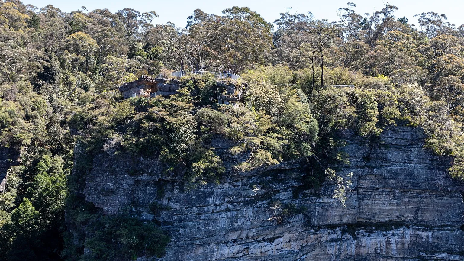
Sloping sites attract development because the view is the product. They also carry a risk that does not appear on a survey plan and does not show up in a comparable sale: the ground itself. In New South Wales, slope can trigger a specific planning control, and on some land the state's landslide risk provisions sit as additional local provisions in the relevant environmental planning instrument. The question for a deal-maker is not whether the site is beautiful. It is whether the hazard has been classified before money is committed.
Start with what the planning instrument already says about your site
Before you commission anything, find out whether the land is already identified. The NSW Planning Portal publishes an Environmental Planning Instrument Landslide Risk dataset, which identifies land where development implications exist due to the Landslide Risk for certain areas as designated by the relevant NSW environmental planning instrument. Those provisions sit as additional local provisions in Part 6 of the instrument, and they carry obligations about how the risk of development is managed.
So the first test is documentary: is the lot shown on the landslide risk map for its local government area, and what does the clause in that instrument require? A planner can answer that in a day, and it is far cheaper than discovering it after exchange.
What a council control looks like in practice
Councils then add their own layer. Take Camden Council as a worked example, being explicit that this is Camden's rule and not a statewide standard. Camden's Development Control Plan section 2.20 applies to development applications for land subdivision, civil works and new buildings on or adjoining ridgeline land and/or land that has a gradient of 15 per cent or greater, and defines steep land as land which has a gradient of 15% or greater.
The control is a bar, not a guideline. Camden's DCP states that development on land having a natural gradient of 15% (1:6.7) or greater must not be approved unless a geotechnical study, including guidelines for structural and engineering works on the land, has been considered by Council. It also states that subdivision plans must demonstrate consistency with the section notwithstanding any minimum lot size standard applying to the land — which means passing the minimum lot size test does not get you past the slope test.
What a geotechnical assessment has to answer
A geotechnical report is not a generic soil test. On a steep site it has to produce findings the design and the approval can actually rely on. Camden's DCP lists the outputs it expects, and they are a useful checklist anywhere in NSW:
- Geotechnical and land stability conditions for the site, including what the ground will and will not support.
- A land instability risk profile, so the hazard is characterised rather than asserted.
- Hazardous areas of landslip and runout risk in which urban building structures and infrastructure are to be excluded, having regard to any stabilisation measures proposed.
- Engineering and other measures for land stability, such as vegetation retention and rehabilitation, surface and subsurface drainage, landforming, landscape surface treatments and erosion control during construction and operation.
For subdivision, the DCP asks for building envelopes on each lot, driveway locations, interallotment drainage and covenants on title — the physical and legal mechanism that keeps future dwellings out of the hazardous areas. If your subdivision plan does not carry those, the geotechnical findings are not actually being applied.
The technical framework behind the report
The practitioners preparing those reports work to a published Australian framework rather than to individual preference. The Australian Geomechanics Society guidelines from 2007 include the Practice Note Guidelines for Landslide Risk Management and its commentary, a landslide zoning guideline for land use planning, and the slope management GeoGuides. They set out how landslide susceptibility, hazard and risk are zoned for planning purposes, and the practice note is the document that deals with project-specific landslide risk assessment and tolerable levels of risk. Knowing that framework exists is useful when you read a report: you can ask whether the assessment was done to it.
A practical pre-purchase test
- Pull the planning instrument and check whether the site is identified as landslide risk land, and read the clause.
- Read the council's development control plan for slope and ridgeline controls, and note the gradient threshold it uses.
- Get a surveyor's plan of the actual levels and boundaries — a contour line is not a slope analysis.
- Commission the geotechnical assessment in due diligence, not after exchange, and ask specifically for the hazard classification and the excluded areas.
- Cost the drainage, retaining, earthworks and stabilisation measures the report requires into the feasibility.
- Ask the planner whether the consent authority will require the report to be updated or peer reviewed as part of the application.
- Check whether access and driveway grades are achievable within the council's standards, because a steep site can fail on access before it fails on stability.
The common trap
The trap is buying the view and pricing the ground as an afterthought. Three specific versions of it:
- Treating the minimum lot size as the feasibility test. Camden's own control states that the slope provisions apply notwithstanding the minimum lot size standard. A compliant lot can still be unbuildable in practice once the hazardous areas are excluded.
- Assuming a desktop study is enough. A hazard classification that excludes building from part of the site can only be tested against real levels and real inspection.
- Forgetting the ongoing obligation. Stabilisation, drainage and vegetation controls often carry through to covenants on title and maintenance obligations. A site can be approvable and still be expensive to own.
What a capable student does next
You are not expected to assess slope stability. Brief a geotechnical engineer to inspect the site and classify the hazard, a town planner to confirm exactly which instrument, clause and map applies, a civil engineer to resolve stormwater, subsurface drainage and access grades, and a licensed surveyor to provide the levels and boundaries the analysis rests on. The specialists perform the technical assessment and confirm the site-specific answer with the consent authority. Your job is to recognise the trigger early, put the geotechnical work inside due diligence, and price the mitigation before you commit.
Sources and boundaries
Sources checked 7 October 2026. Jurisdiction and limits: New South Wales only. The landslide risk dataset and environmental planning instrument provisions are NSW instruments, and the gradient control quoted is Camden Council's own development control plan example, not a statewide rate or standard. Other NSW councils have their own slope and hazard controls, and other states and territories use their own systems. All sources were read on 7 October 2026.
- Camden Council — Development Control Plan section 2.20 Ridgelines and Steep Land. Used for: States that the section applies to development applications for land subdivision, civil works and new buildings on or adjoining ridgeline land and/or land that has a gradient of 15% or greater; defines steep land as land which has a gradient of 15% or greater; requires that development on land having a natural gradient of 15% (1:6.7) or greater must not be approved unless a geotechnical study, including guidelines for structural and engineering works on the land, has been considered by Council; requires a geotechnical assessment addressing geotechnical and land stability conditions, a land instability risk profile, hazardous areas of landslip and runout risk in which urban building structures and infrastructure are to be excluded, and engineering measures for land stability including surface and subsurface drainage, landforming and erosion control; requires subdivision plans to identify building envelopes, driveway locations, interallotment drainage and covenants on title; and states that subdivision plans must demonstrate consistency with the objectives and controls of the section notwithstanding any minimum lot size standard applying to the land. (Checked 7 October 2026)
- NSW Planning Portal — Environmental Planning Instrument: Landslide Risk (dataset). Used for: Describes a spatial dataset identifying land where development implications exist due to landslide risk for certain areas as designated by the relevant NSW environmental planning instrument; states that the instrument contains provisions relating to landslide susceptibility conditions and identifies how risks of development are managed, and that these are additional local provisions found in Part 6 of the instrument; and records the dataset's coverage, update frequency and Creative Commons attribution licence. (Checked 7 October 2026)
- Australian Geomechanics Society — Landslide Risk Management guidelines. Used for: Publishes the AGS 2007 suite on landslide risk management, including the Practice Note Guidelines for Landslide Risk Management 2007 and its commentary, the Landslide Zoning Guideline for land use planning, and the Australian GeoGuides for slope management and maintenance, which together provide the technical framework and the tolerable risk levels used by practitioners when preparing a site-specific landslide risk assessment. (Checked 7 October 2026)
- Australian Geomechanics Society — Practice Note Guidelines for Landslide Risk Management. Used for: Records that the Practice Note Guidelines for Landslide Risk Management and its commentary are one part of a series of three guidelines, and that the series supports practitioners, regulators and property owners in managing landslide hazard, including the identification of landslide hazard in the planning process and the management of properties subject to landslide hazard. (Checked 7 October 2026)
This article is general education, not personalised planning, legal, financial, tax or building advice. Requirements and outcomes vary by jurisdiction, site, contract, structure and circumstances. Check current information with the relevant authority and appropriately qualified advisers.
 Learn with Jason & AmyBuild practical small-scale property development skills with experienced mentors.Enquire now
Rate this article
Guest rating: select 1 star for poor or 5 stars for great. No account is required.
Leave a comment
Join the discussion. Your email address will not be published.
Frequently asked questions
What slope makes a New South Wales site steep land?
There is no single statewide number. Individual councils set their own thresholds in their development control plans; Camden Council's plan, for example, defines steep land as land with a gradient of 15% or greater and applies the section to land with a gradient of 15% or greater. Confirm the threshold in the development control plan for your own council, and check whether the site is also identified in a landslide risk map.
Is a landslide risk map the same as a council control?
No. The state's landslide risk dataset identifies land where development implications exist as designated by the relevant environmental planning instrument, with those provisions sitting in Part 6 of that instrument. A council development control plan is a separate layer that can impose its own slope and ridgeline requirements. Both can apply to the same site.
Can I satisfy the slope control by making the lots bigger?
Not automatically. Camden Council's control states that subdivision plans must demonstrate consistency with the objectives and controls of the section notwithstanding any minimum lot size standard applying to the land, so a compliant lot size does not by itself resolve a slope or stability issue.
What should a geotechnical assessment actually produce?
At minimum a hazard classification for the site, a land instability risk profile, identification of hazardous areas where building structures and infrastructure should be excluded, and the engineering measures the design relies on, including surface and subsurface drainage, landforming, stabilisation and erosion control. For a subdivision, those findings should then appear as building envelopes, driveway locations, interallotment drainage and covenants on title.
Is there a published standard for landslide risk assessment in Australia?
Yes. The Australian Geomechanics Society published a suite of guidelines in 2007, including the Practice Note Guidelines for Landslide Risk Management and its commentary and a landslide zoning guideline for land use planning, which practitioners use for site-specific landslide risk assessment and for setting tolerable levels of risk.
Photo: 'Katoomba (AU), Duke of York Lookout -- 2019 -- 1867' by Dietmar Rabich, Wikimedia Commons, CC BY-SA 4.0
Loading comments…